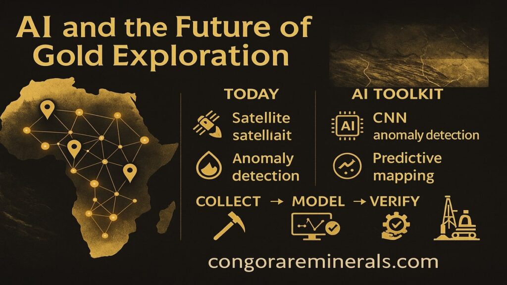
Finding new gold deposits used to rely on slow fieldwork and luck. Today, AI, remote sensing, and better data can cut false leads and help us source gold more responsibly. Here is how the tech works, why it matters for ethical supply chains, and what buyers gain from it.
The short version
- Satellites and drones collect clean, repeatable data over large areas.
- Machine learning turns that data into ranked targets so geologists spend time only where it counts.
- Strong governance and verification keep results credible and support responsible sourcing.
The new toolkit
1) Satellite imagery for first pass screening
- Multispectral sensors like Landsat and Sentinel-2 help map alteration minerals, vegetation stress, and soil signatures linked to hydrothermal systems.
- Radar such as Sentinel-1 SAR sees through clouds and detects surface roughness and subtle structure.
- Higher resolution options like ASTER and commercial constellations (for example PlanetScope) refine the view.
2) Geophysics meets pattern recognition
Magnetic, radiometric, gravity, and EM data feed models that learn how known deposits “look.” AI flags combinations of lineaments, intrusions, and alteration halos that humans can miss at scale.
3) Drone mapping for fast ground truth
Drones shoot centimeter-level orthomosaics and LiDAR point clouds. Models compare drone data with satellite anomalies to confirm structure, access routes, and drill pads before any heavy footprint.
4) ML models that rank targets
- Classification models separate likely vs unlikely zones.
- Regression estimates probability scores that guide the next dollar of fieldwork.
- Active learning loops new samples back into the model so accuracy improves after each campaign.
Why this makes sourcing more ethical
- Less disturbance per ounce. AI narrows the search area, so you dig fewer trenches and drill fewer holes.
- Transparent footprints. Satellite archives are public and time-stamped, which helps document where work happened and what changed.
- Cleaner handoff to compliance. Targets and results roll into our due diligence files alongside the OECD guidance. That supports the claims we make on our Responsible Mining page.
From pixels to proof
- Assemble data
Historic occurrences from sources like the USGS MRDS database, geology maps, past geophysics, plus new satellite scenes. - Pre-process
Correct for atmosphere, topography, and illumination. Build indices like clay alteration or iron oxide maps. - Model and rank
Train on known deposits. Score the region for similarity. Produce a short list. - Field verification
Walk the site, sample rock and soil, and use handheld XRF. For bigger programs, run IP or EM lines. - Independent testing
Confirm grades and purity through our in-house process and third parties. See Lab Testing and Refining.
Everything above becomes part of the chain of custody that travels with the metal.
What buyers actually gain
- Availability. Better exploration feeds future supply.
- Traceability. More data at the start means cleaner paperwork at the finish.
- Pricing clarity. When origin and specs are verified, bids tighten and resale is easier.
Practical example setups
Early-stage regional scan
- Input: Sentinel-2, ASTER, SRTM elevation, regional magnetics.
- Output: 10 km blocks ranked by alteration and structure overlap.
- Action: small field team visits only the top decile targets.
Drill-ready refinement
- Input: drone orthomosaic, LiDAR, ground magnetics, soil geochem.
- Output: 3D targets along shear zones with trench positions.
- Action: minimal pads, short program, firm decision to proceed or stop.
Data governance that keeps this real
- Provenance first. Every dataset is logged with source, date, coordinates, and license.
- Model audits. Keep versions, features, and training sets so results can be repeated.
- Community and environment. Blend risk layers that avoid protected areas, water courses, and settlements.
- Continuous verification. Lab certificates and bar lists link back to project IDs at the export stage.
How Congo Rare Minerals uses this in practice
- We use AI screening to focus field time and reduce disturbance.
- We document results and include them in the compliance pack you receive with shipments.
- We support independent checks through Lab Testing and Refining.
- For quotes or collaboration on exploration data, reach out via Contact.
- Ready to buy verified product today. Visit the Shop.
FAQ
Does AI replace geologists
No. It narrows the map so geologists can work where the odds are better.
What if satellite data is cloudy or noisy
Radar fills the gaps, and we resample on clear passes. Field checks decide the final call.
Can AI help avoid high-risk areas
Yes. Models can mask protected zones, cultural sites, and water buffers to keep projects compliant and lower social risk.

